
In January Sara and I were looking for a new adventure and our favorite hiking website – HikingGuy.com was talking about doing the Trans Catalina Trail (TCT). So, we started making plans to stay and researching how to do it and a training plan. The TCT is a trail that traverses Catalina Island about 20 miles off the coast of southern California. This 38.5 mile very hilly course covers beautiful coves and beaches on both sides of the island with ocean views forever. We opted for a bed and breakfast instead of camping and booked our ferry rides back and forth from the island.
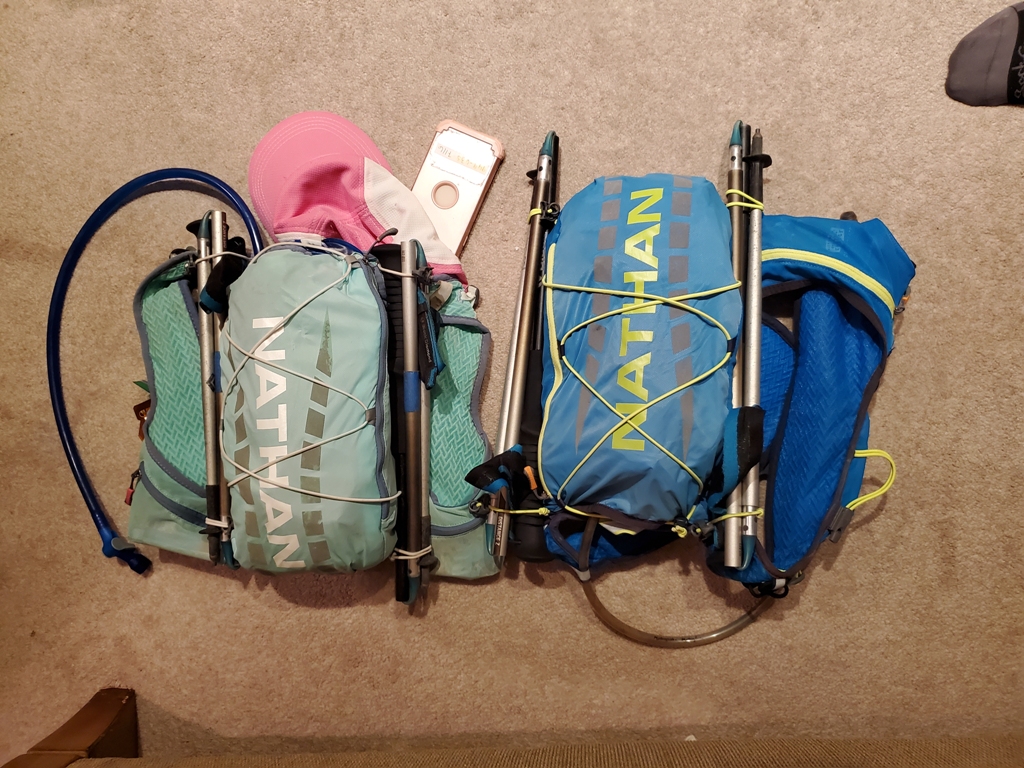
Below you can see our packs, poles, food and gear for the trail run. We decided to do it in one day, so we needed to carry all of our food and supplies. Our bladders carry 2 liters of water, and between the GU powder for electrolytes and the food we carried, we had about 3,500 calories each.

This is what the packs looked like with all of the gear and food ready to go the night before. We needed to get to bed early because we had to catch the 6am ferry out of Long Beach. O dark thirty came pretty quick. We set 3 alarms to make sure we were up in time.
We had plenty of time to make it to the Catalina Express in Long Beach with 30 minutes to spare. However, there are two launch points and we went to the wrong one first. If it wasn’t for a friendly tourist from Northern Cal who helped us, we wouldn’t have made it. We rushed to the other berth like a bat out of hell and made it with 3 minutes to spare.
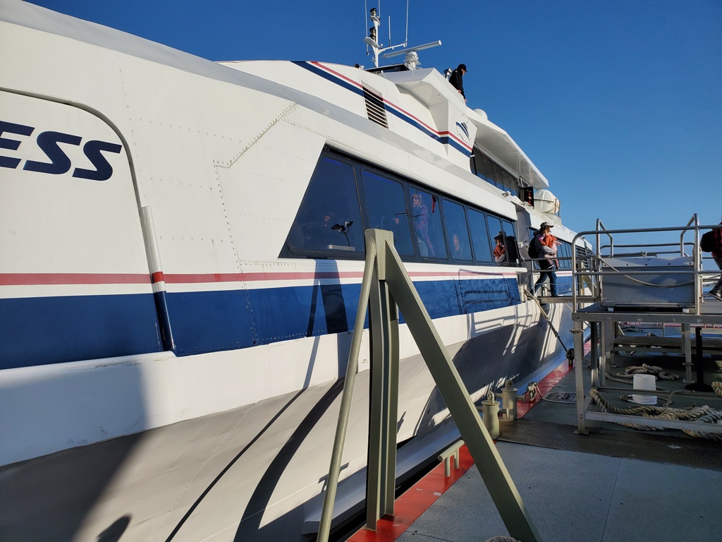
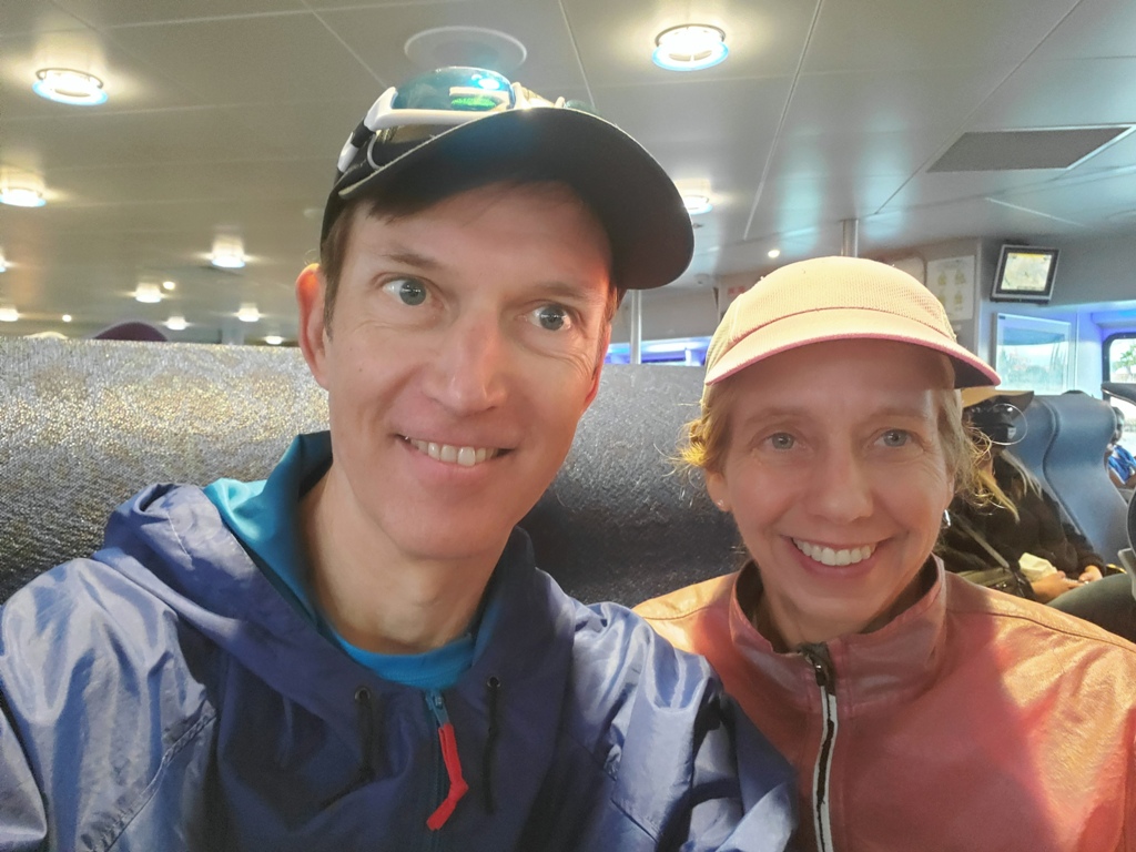
Having boarded we found some seats and were excited to rest for the smooth trip 75 min trip over to Catalina. It was such an adrenaline rush to get to the boat on time, so we were happy to rest and prepare our shoes and packs.
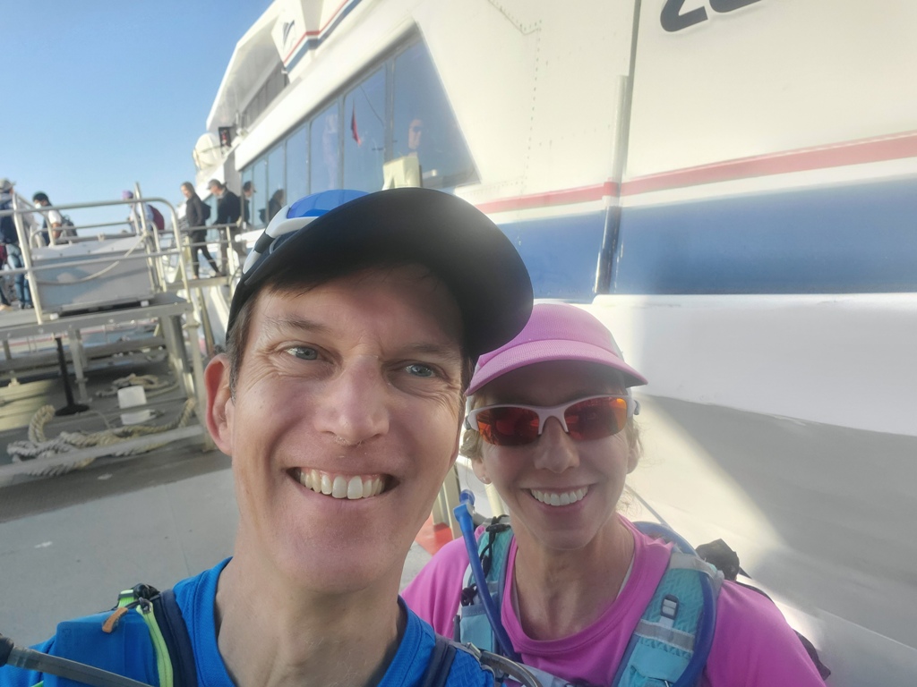
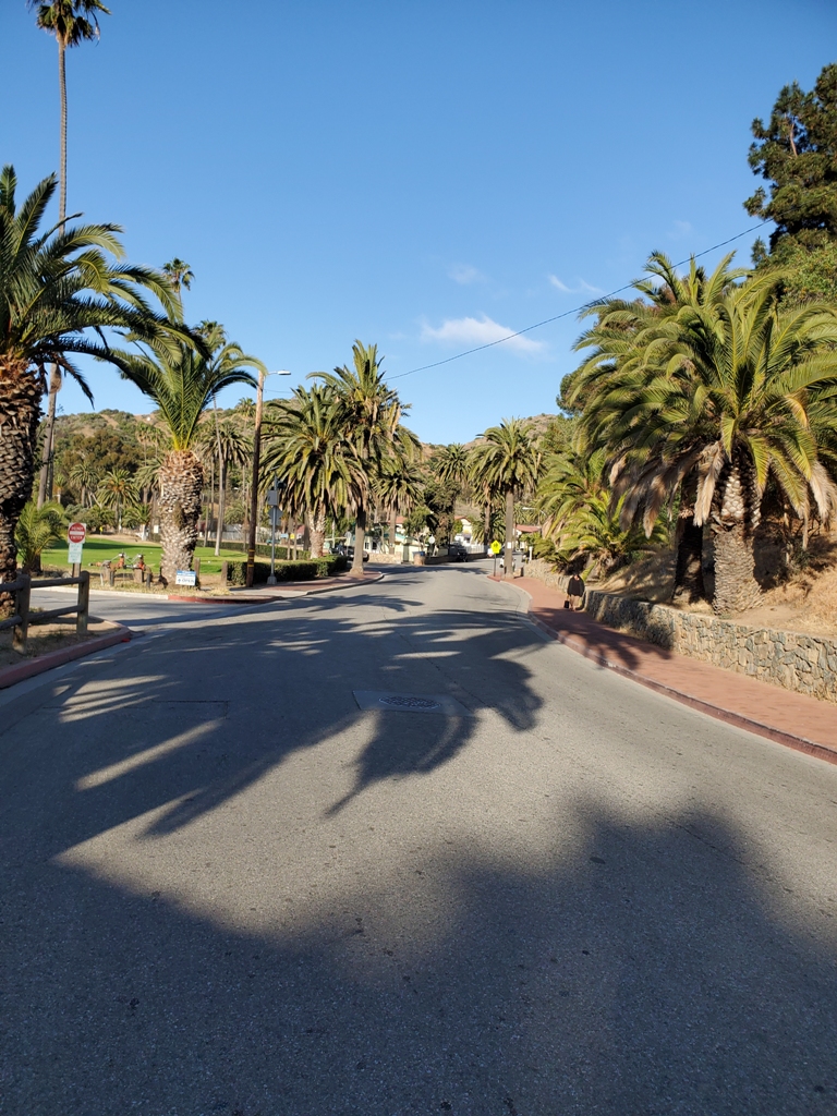
We arrived in Avalon at 7:14 am and were the first to get off. We literary hit the ground running from the pier and down the street. Man, did our packs feel heavy ;).
Frist up through the middle of town, very quiet at this time of day and no cars moving.

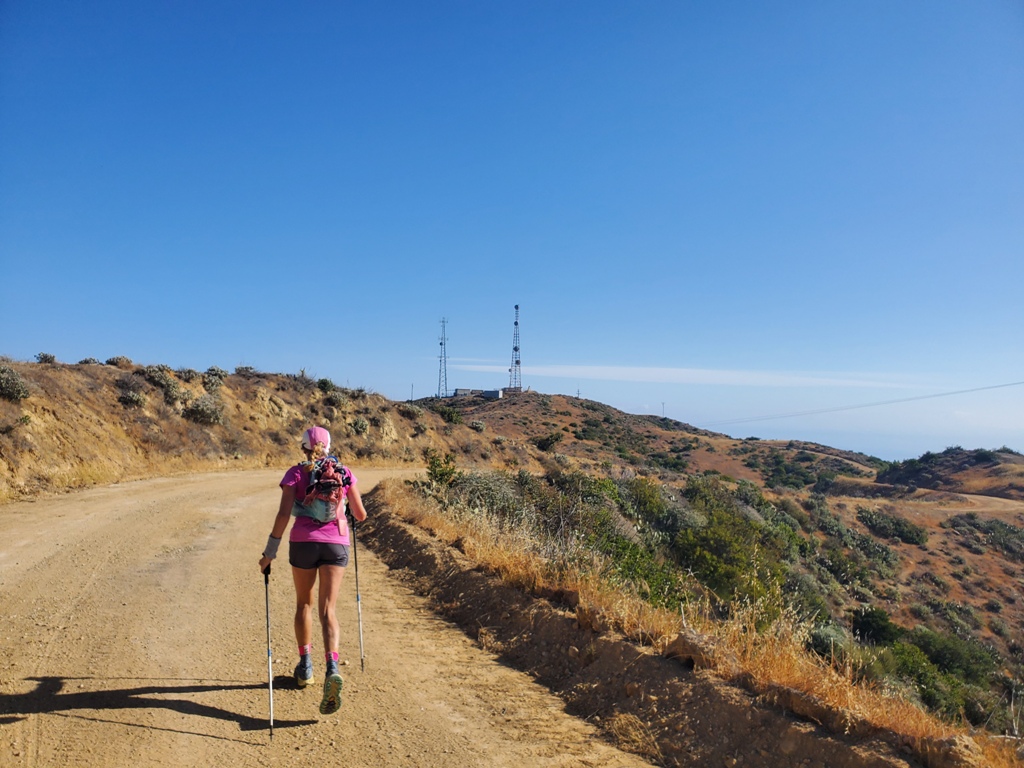
In a couple of long blocks we saw the golf course on our left and started to run alongside it going inland. Did I mention everything from the water is basically going uphill. There was a slight cool in the air but the sun and clear skies beckoned warmer weather to come.

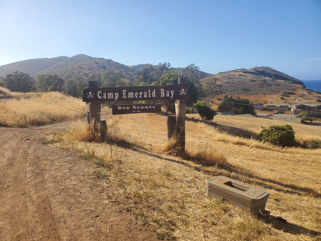
We kept running up Avalon canyon road until we came upon the entrance to Hermit Gultch campground at a fork in the road.
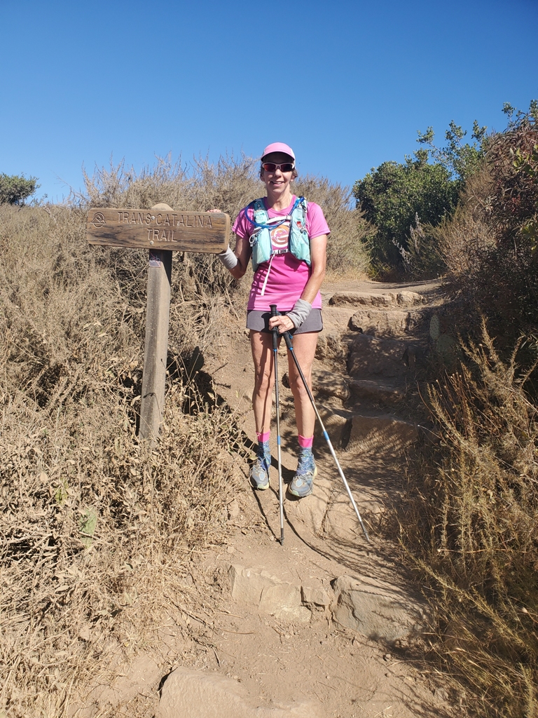
We ran through the campground to the start of the TCT at this sign. It’s pretty wild that if you weren’t looking for it you could run right by it. We took our pictures and headed up the trail.

The trail started going up right from the start.
The trail winds up the mountain for about 1200 feet until Divide road and along the way the views keep getting better.

From the lookouts on the way up you can see Avalon Harbor in the distance following the valley to the water.
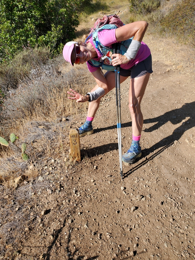
The trail is marked really well including mile markers that are really accurate from the starting point at the pier.
Reaching the Hermit Gultch Viewpoint for the first climb, we were happy to be on our way.

We then headed onto Divide road and headed toward those radio towers. It was nice to be running and the views were pretty spectacular up here.
After quite a bit of running, we came to this first gate and as we went through, we heard another couple running behind us. We ran passing each other for a while and then introduced ourselves. They were college students: Shilpa from UCLA and her friend visiting from Colorado. They were doing the first part of the trail 24 miles finishing in time to catch the ferry back on the same day. We thrived on their energy.

We next came upon Haypress pond which a natural water source. It was a beautiful setting in the morning light.

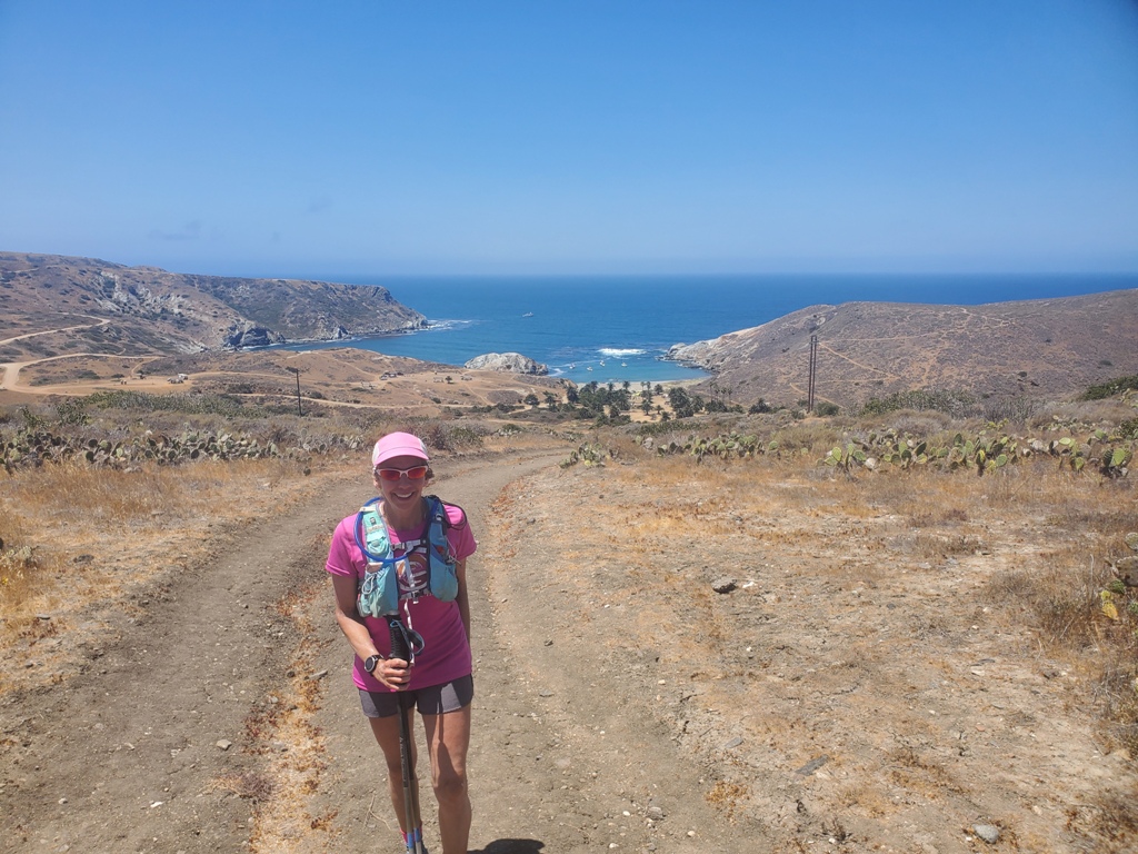
We continued up the single track trail, crossed the main road and then headed onto the single track again.
The views up here always seem to impress whether we are looking down on the east or west side of the island.

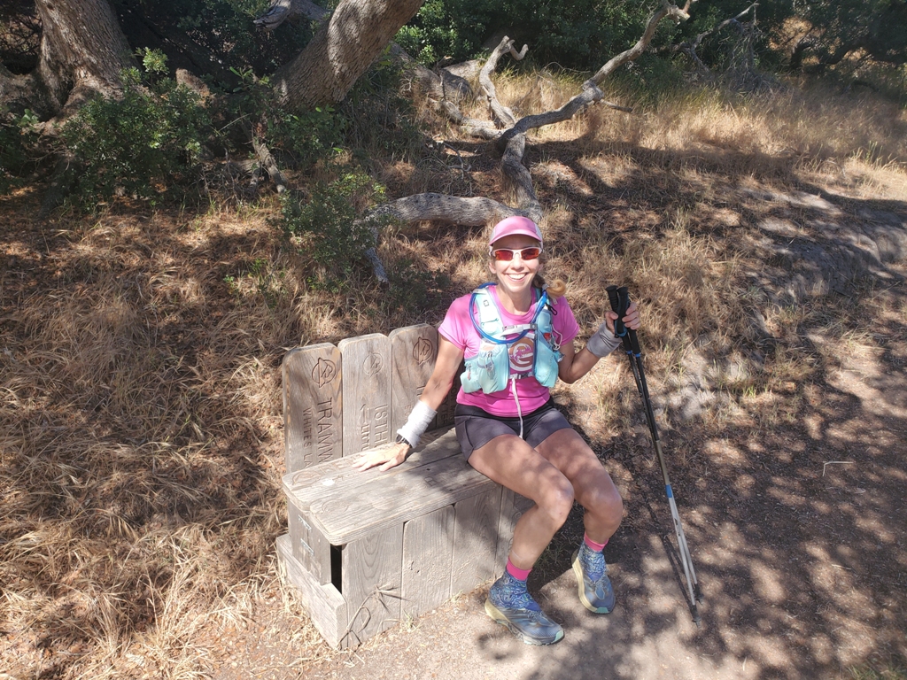
This cool chair is made of old trail signs. Sara looks good on it, but I looked like a giant. It was a nice distraction and another landmark to check off.
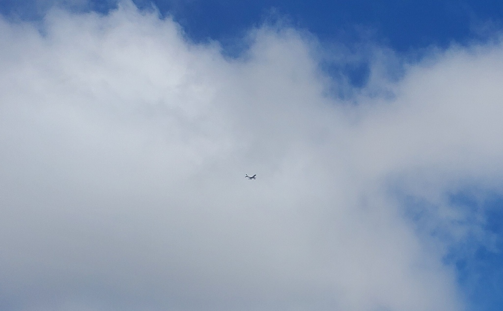
Next we ran around the Airport. It was pretty busy on this holiday weekend. Saw this plane taking off and flying overhead.
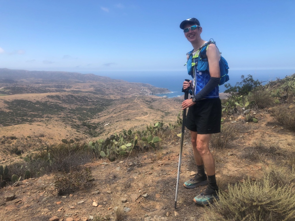
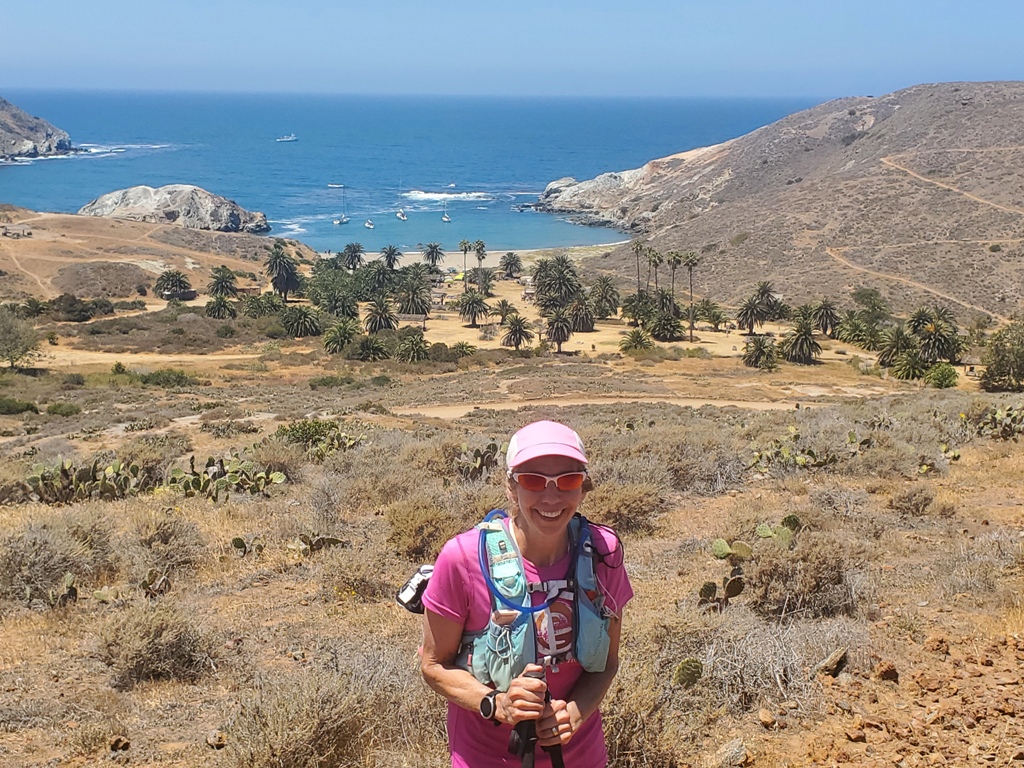
This is our first glimpse of little harbor as we kept moving North on the island.

The trail would take us to the highest point before taking us straight down to the beach again to do it all over again. This is the view of Little Harbor before we descended.
The path now started to descend into little harbor.

The views just kept getting clearer and clearer as we kept descending.
Here you can see Little Harbor, the beach and the campground under the Palm trees. Off to the right you can see the zig zag of the TCT going up from the beach and where we headed after a water stop at the campground.
Each of our water stops was similar. We open our packs, pull out our bladders and our GU powder. We refill with water and 4 scoops of powder while drinking as much as we can during this process. We are able to drink a lot of calories this way. We also make sure we eat some food and reapply sunscreen before starting out again.

This camping area had some amazing palm trees and this is just one of them. We really loved this beach and would love to come back again.

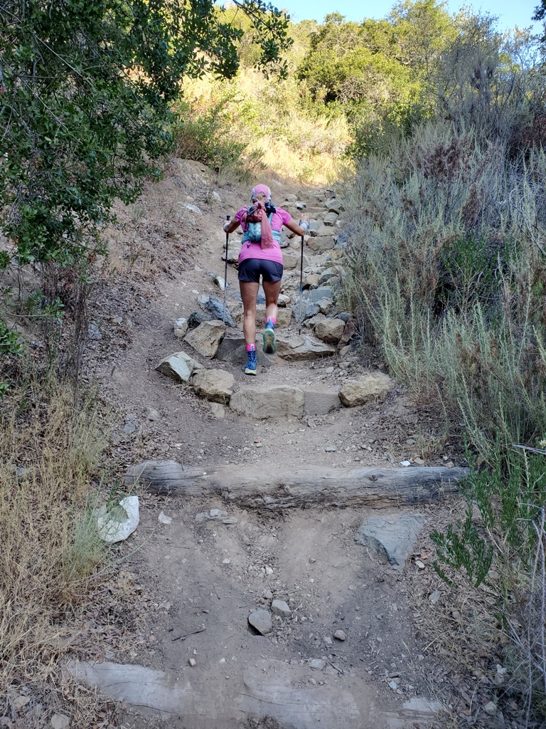
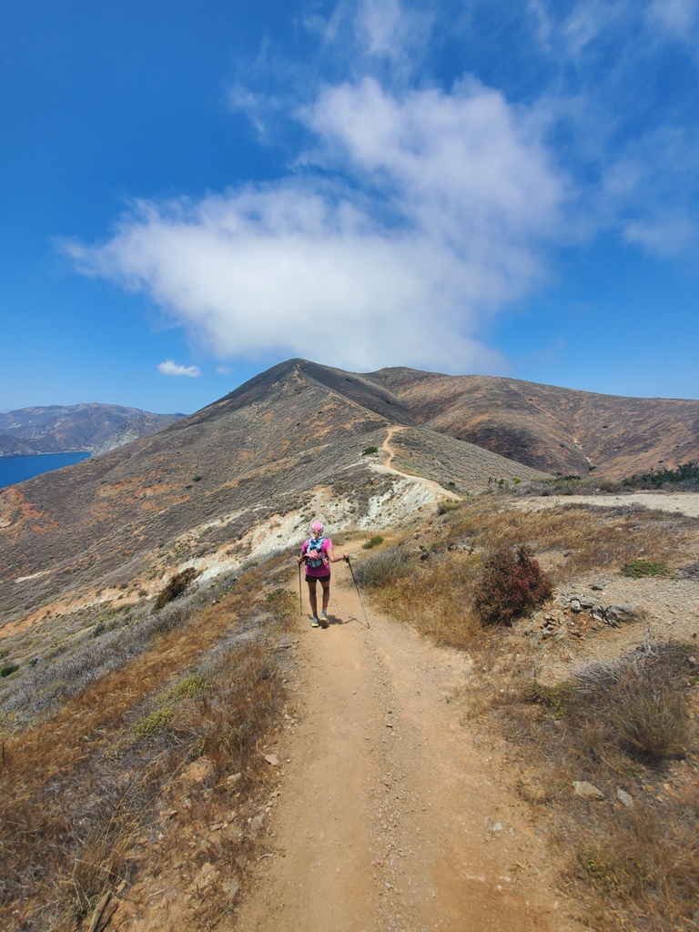
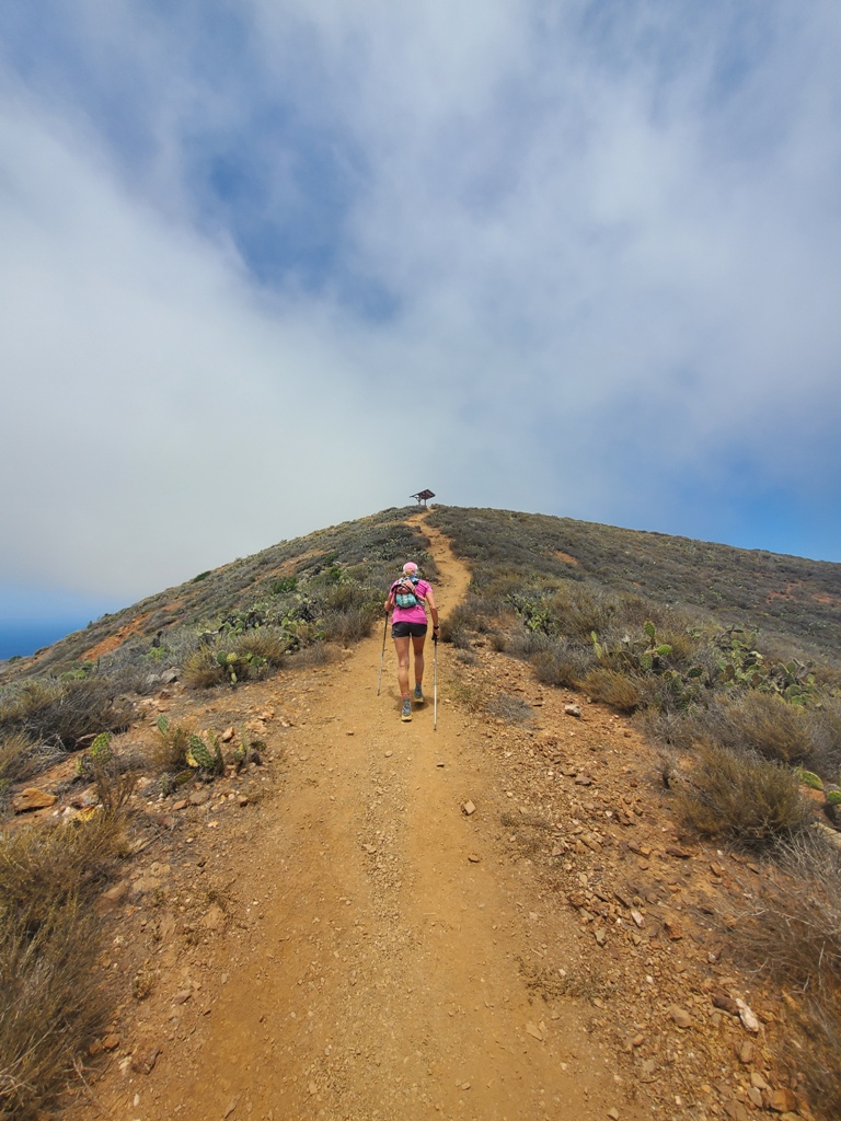
Next it was climbing again up the switch backs from the beach.

The trail continued like this as you can see up and up with breathtaking views to the left hundreds of feet down to the water
The colors and the views of the shoreline mountains down to the water were beautiful.
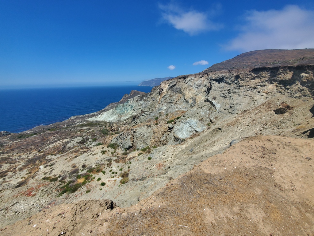
This part of the trail continued up and just kept getting steeper with rocks and a cliff down the left side to the ocean.

When we saw the bench at the top of the hill, we were really excited to be done climbing for now.
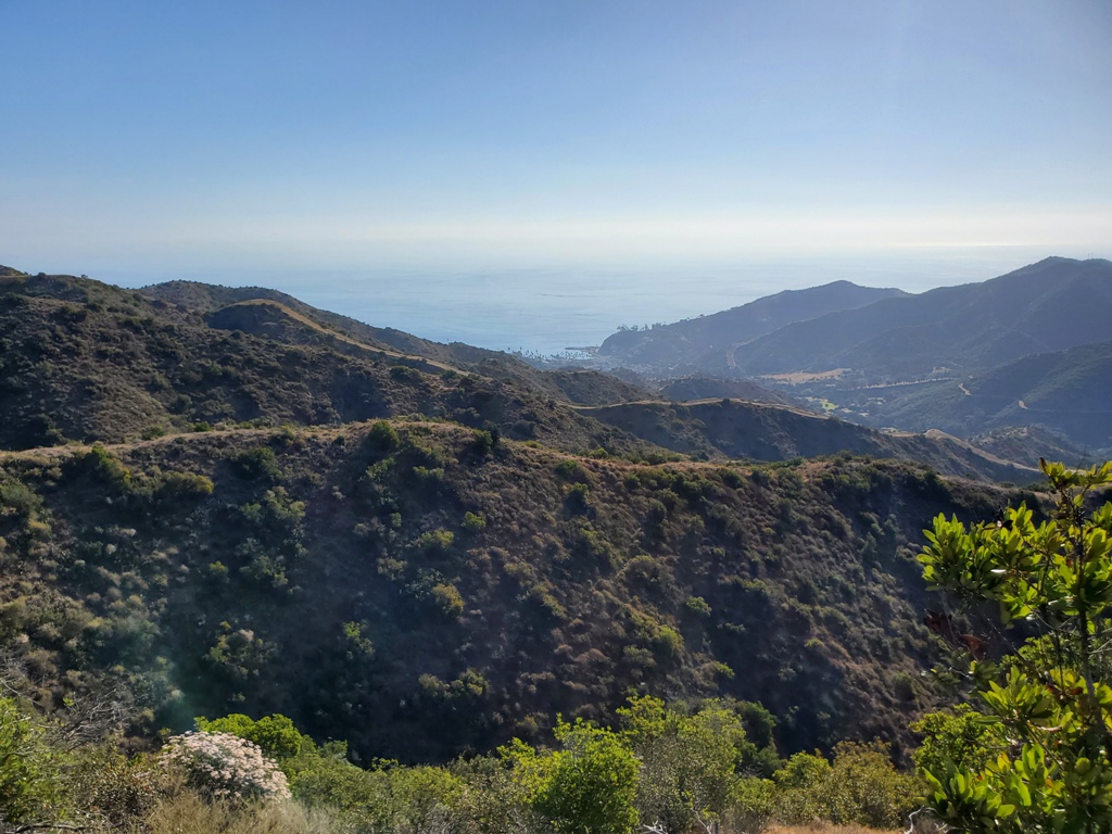
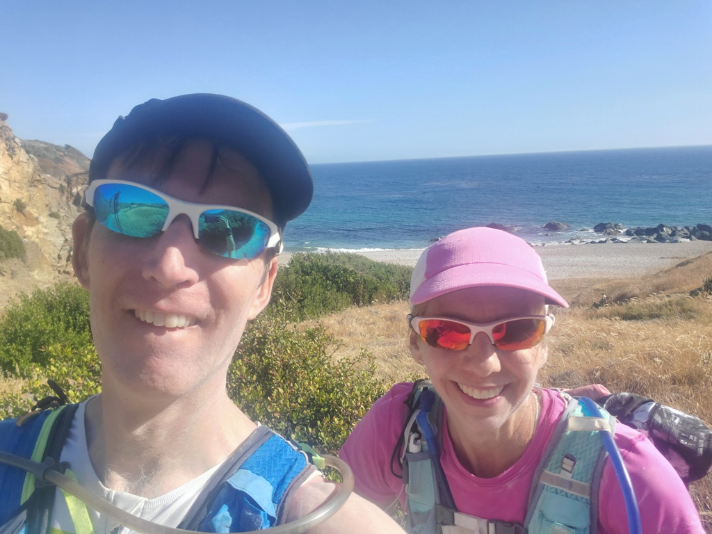
As we descended, we could see the west harbor of Two Harbors and the beautiful water – more on that soon. If you look at the far-right side of the harbor you can also see the trail going straight up the mountain. That will be in our near future after another water stop – more to come there too.

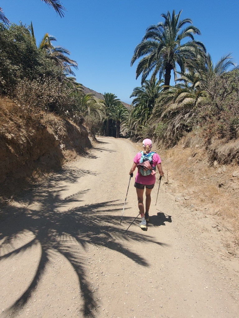
It was a very steep descent into two harbors. Palm trees were a welcome site after being out on the desert landscape. Without knowing it we also cruised past our hotel for the night on the left side of the road. Probably good we didn’t see it… would have been too tempting to stop for a rest 🙂
Next it was down into Two Harbors to the public bathrooms for a pit stop and to fill up on water, again. This time we filled and extra liter pony bottle as there is no official water stop at Parsons Landing Campground.

The trail led out of town toward the west harbor where the water in the bay looked a beautiful coral blue. Its no surprise that the trail headed up hill again.

The trail/hill heading straight up out of the harbor was punishing and hot. This shot shows somewhat how steep it is, but does not really do it justice. It simply kept climbing and climbing.

After a small traverse on we started descending to Parsons Landing on Fenceline road. It was an extremely steep downhill with loose gravel and scree.

The road went downhill like this for several miles. We joked that we should be “on belay” with a rope. It would have been quicker 🙂

We made it to Parsons Landing and came to the lockers where campers can have supplies delivered. Campers often leave their leftover supplies for others. We lucky enough to find a little extra water to add to the water we brought from Two Harbors.

We were sad to leave the beautiful beach to hit the trail again, but at least this time there were NO MORE HILLS!
As trail leveled off, we ran past several Boy Scout camps with cabins, tents and a harbor.

The trail then moved to the coast and began an 8 mile trek in and out of coves and harbors.

There were private camps like this with matching cabins, mess halls and harbors…
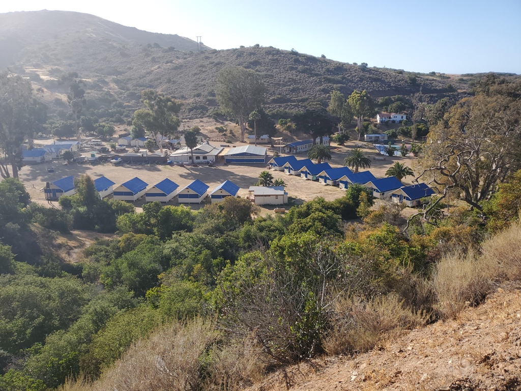
We passed small beautiful harbors with boats and sandy beaches. These last 8 miles were really tough to keep going but we had one goal in mind. We wanted to finish before the only restaurant in town closed. We pushed on just thinking of a juicy burger.

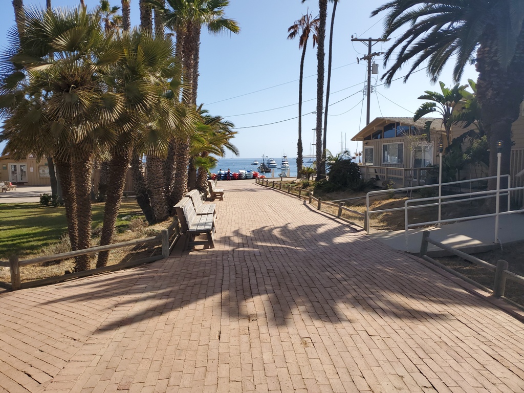
We ran straight into town on the boardwalk and to the resturant.
We ordered, picked up our food and it evaporated into our bodies. Yum

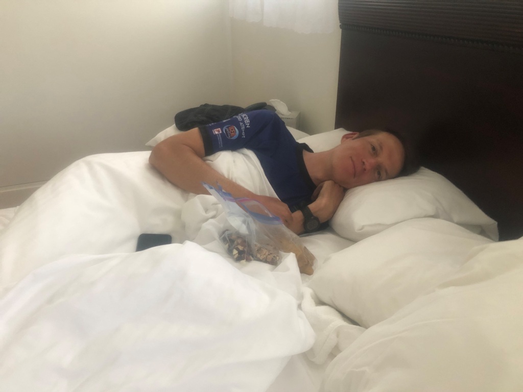
Now for a shower and some rest! We checked in and picked up the care package we had sent to ourselves with clean clothes and snacks.

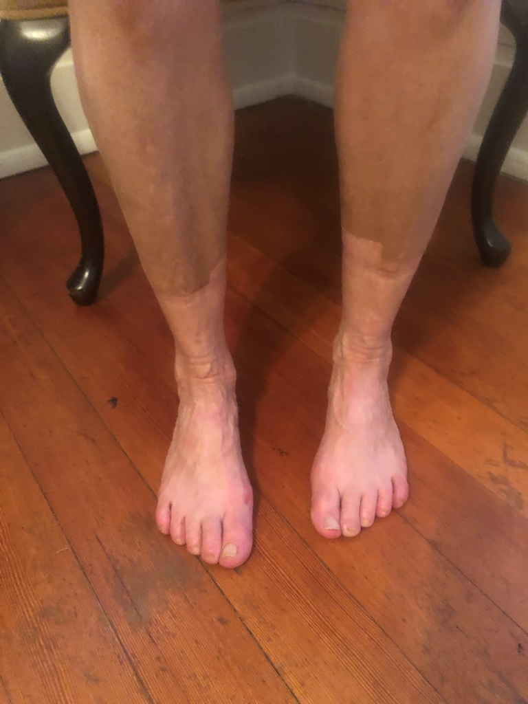
Our legs were caked in dirt and dust, pretty crazy…
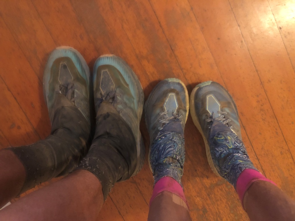
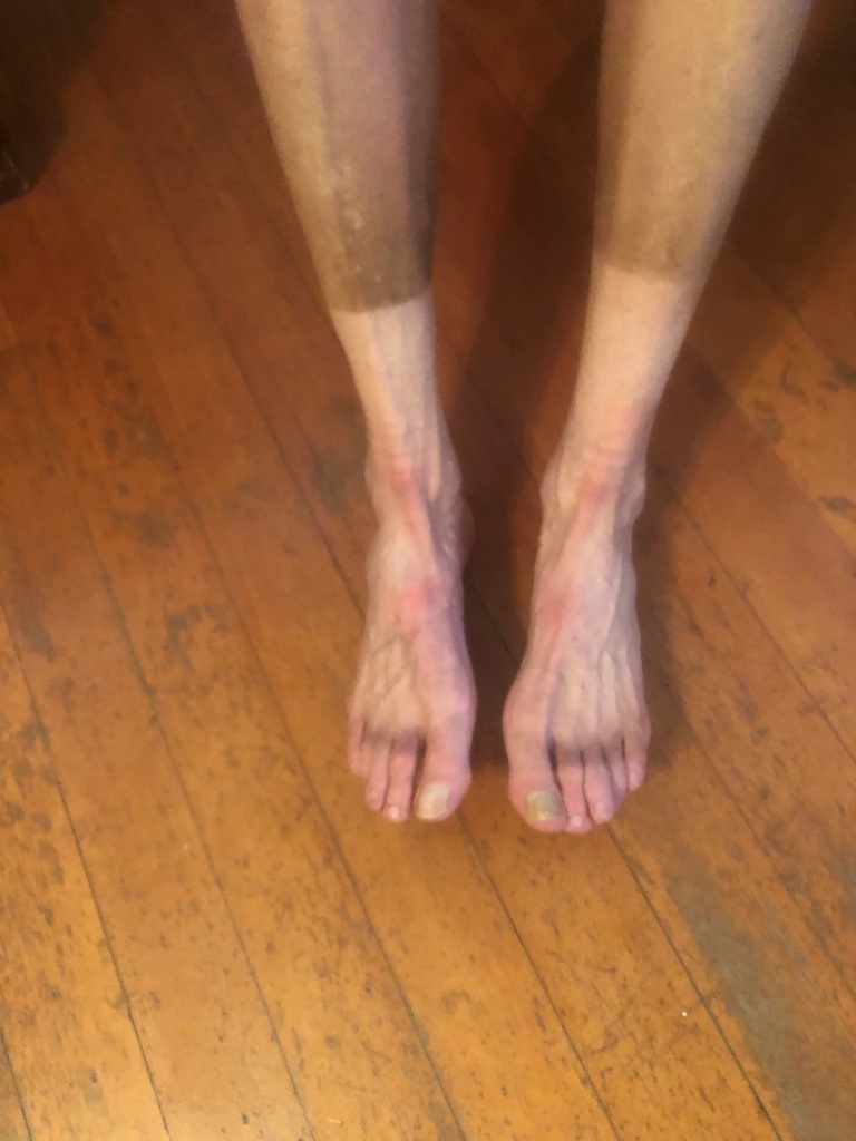
Even easier to see once I took off my shoes and socks – sweet sun/dirt lines
This is going to sound weird but after being so dirty all day, it felt strange getting into such a clean, white bed. The bed was soft and wonderful so after a shower we jumped into bed, ate some snacks 🙂 and fell asleep.
The next morning, we woke up early and went to the kitchen for the continental breakfast. It was just what we needed to refuel.
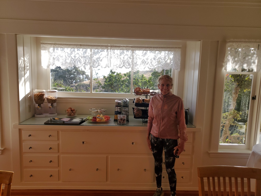
The outdoor patio is awesome. Sunny, comfortable and with a great view of the harbor. We had some breakfast, talked to a great couple starting their trek today and then packed up our room.

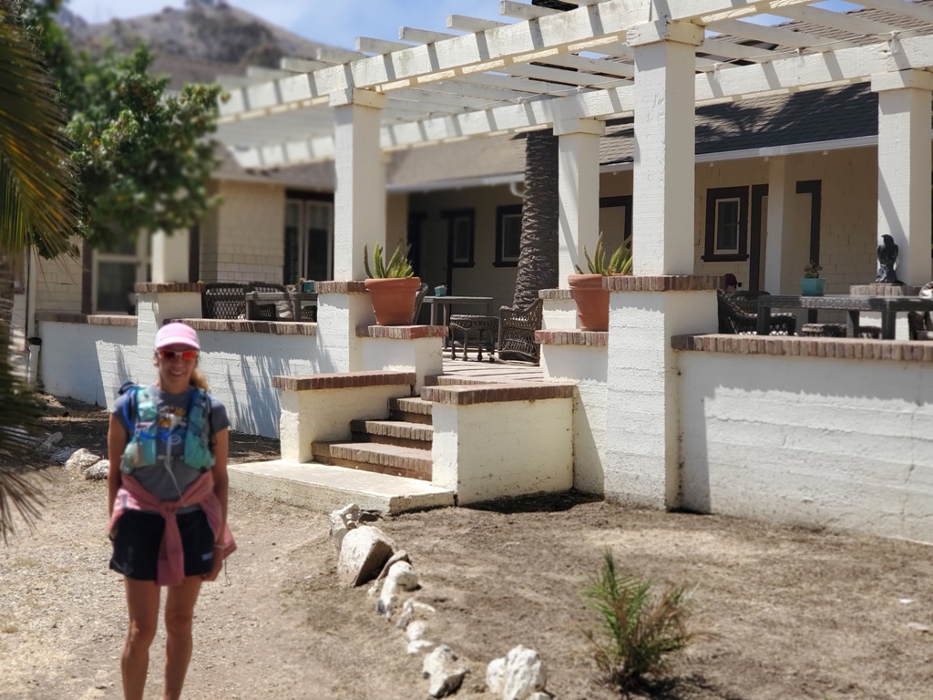
Then we started our walk down to the harbor…
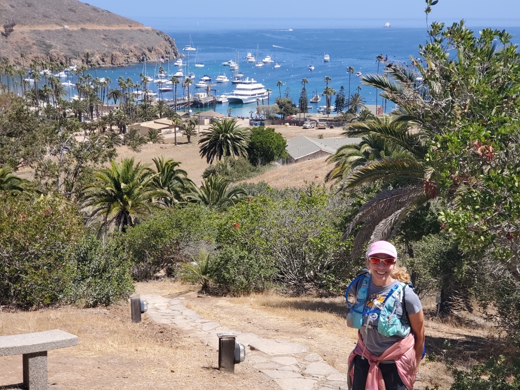
Such a great view from up on this hill. You can see the Catalina Express already docked in the harbor.

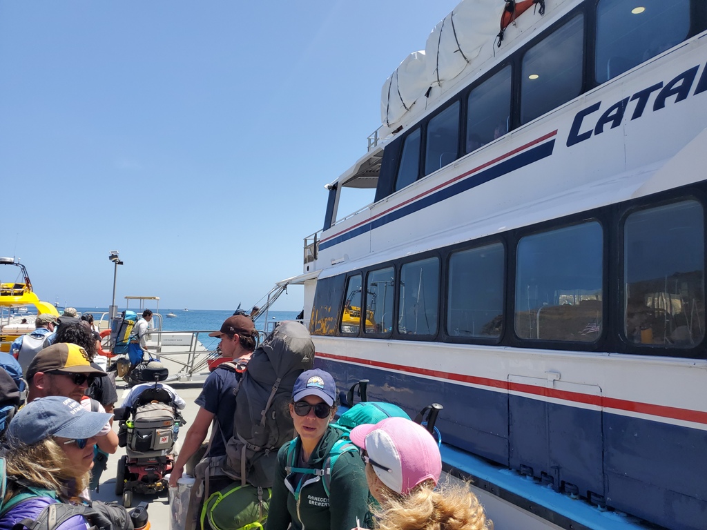
We lined up with the other campers and hikers. The people in front of us in line had a large cooler, a large food bin as well as full packs. When we asked them how they got all those supplies to camp, they said there was a shuttle service for the packs and supplies. Wow, that is the way to camp 🙂
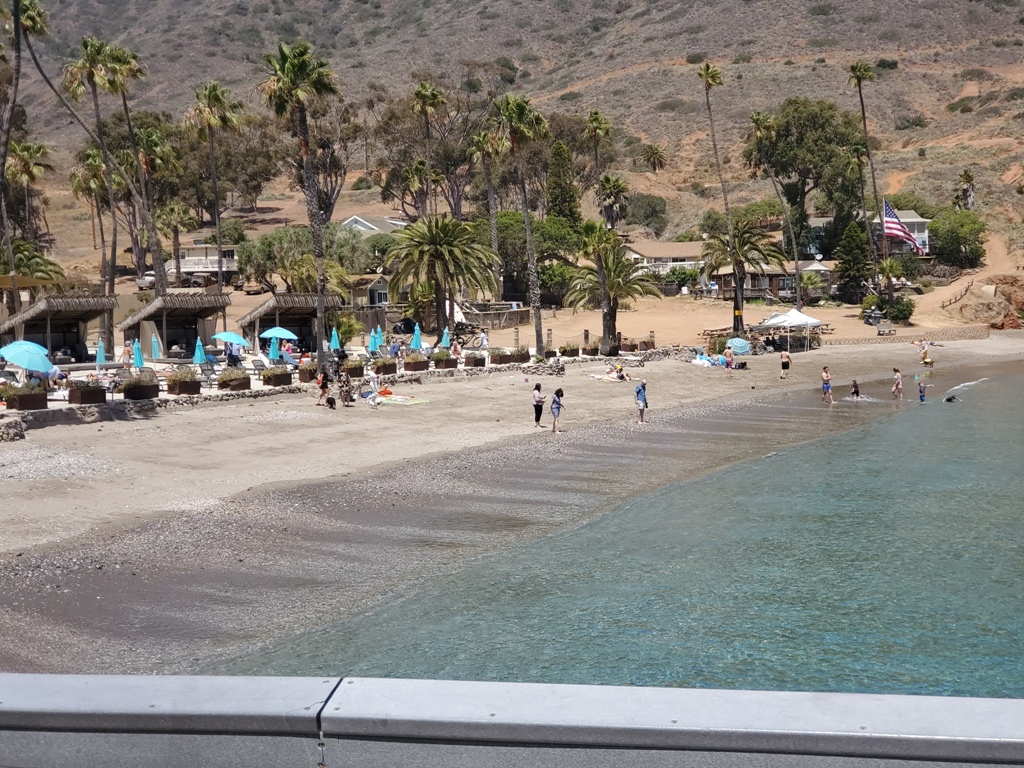
The water and the beach looked so clear and beautiful this morning; it was hard to leave. Even so we loaded up and took the Express back to Long Beach…we will be back again.
Leave a Reply